Tassie may not come immediately to mind when you think of your next trip, but think again – if you’re looking for an active holiday in clean and green surroundings, Tasmania is just a hop and a skip away from most of Australia’s major cities. Its rugged and wild landscape will take you miles away from everyday life, whilst providing some of the world’s most coveted walking trails.
With more than 30 per cent of the state made up of national parks, reserves or World Heritage protected wilderness, there are boundless things for nature lovers to see – from glacially-carved valleys to alpine meadows, to gushing waterfalls and pristine coastlines. Some of these areas are best experienced on foot, so grab your boots and go for a leisurely stroll, a healthy walk or – if you dare – a multi-day trek through the mountains.
Here we bring you the most beautiful hiking trails in Tasmania – there’s something for everyone!
Note: A valid park entry permit is required for visits to Tasmania’s National Parks. Check which one you need here.
Franklin River Nature Trail, Franklin-Gordon Wild Rivers National Park
Best for: mountain peaks, gorges and world-famous rivers
Wheelchair-friendly
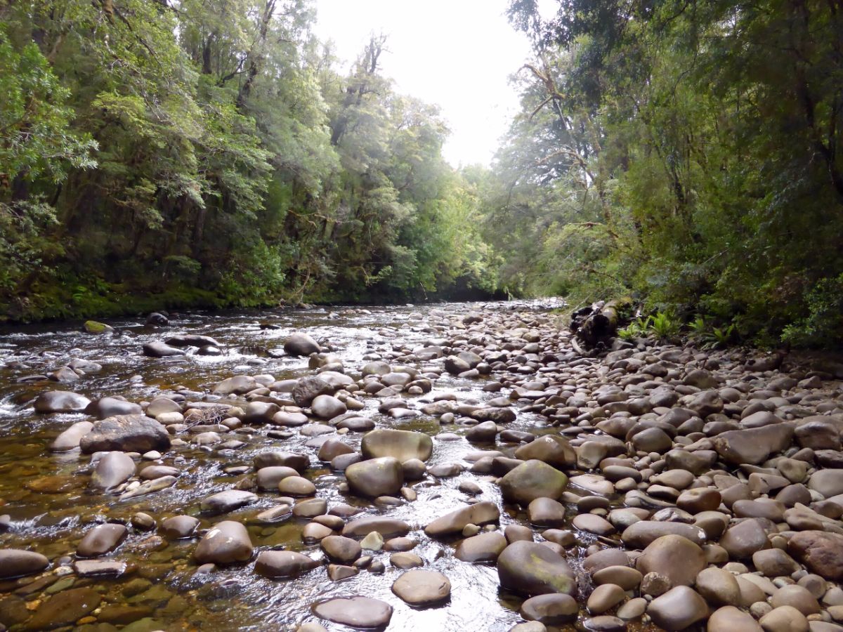
The Surprise River. Photo by Bryn Pinzgauer CC BY.
The Franklin River Nature Trail is wheelchair-friendly and is also ideal for families with small children and strollers, giving walkers of all ages access to one of Tasmania’s most beautiful and lush rainforest walks. The trail passes two remote rivers of outstanding natural beauty: the Franklin River and the Surprise River.
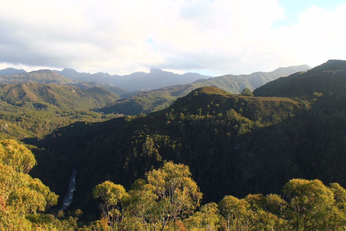
View from Donaghys Lookout. Photo by portengaround CC BY-SA
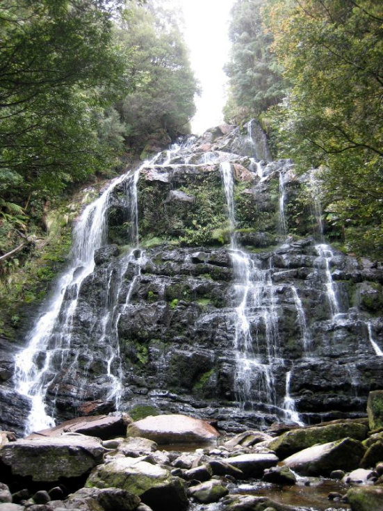
Nelson Falls. Photo by Prince Roy CC BY
For those who prefer a longer hike, the nearby trails to Donaghys Lookout (2km) and Nelson Falls (1km) will give keen walkers an extra hour and a half to enjoy sweeping mountain views and gushing waterfalls. Both of these additional trails are relatively easy to complete and are also suitable for families.
Picnic and toilet facilities are available at the carpark at the beginning of the nature trail, making it an ideal spot to wind down with the kids after a rewarding hike.
Distance: 1km
Time: 30 minutes
Grade: easy
Starting point: Franklin River Bridge
For accommodation that’s only a 45-minute drive away from the nature trail, check hotels in Queenstown here.
Cobler Rocks Walk, Bay of Fires
Best for: white sandy beaches and orange lichen-encrusted rocks
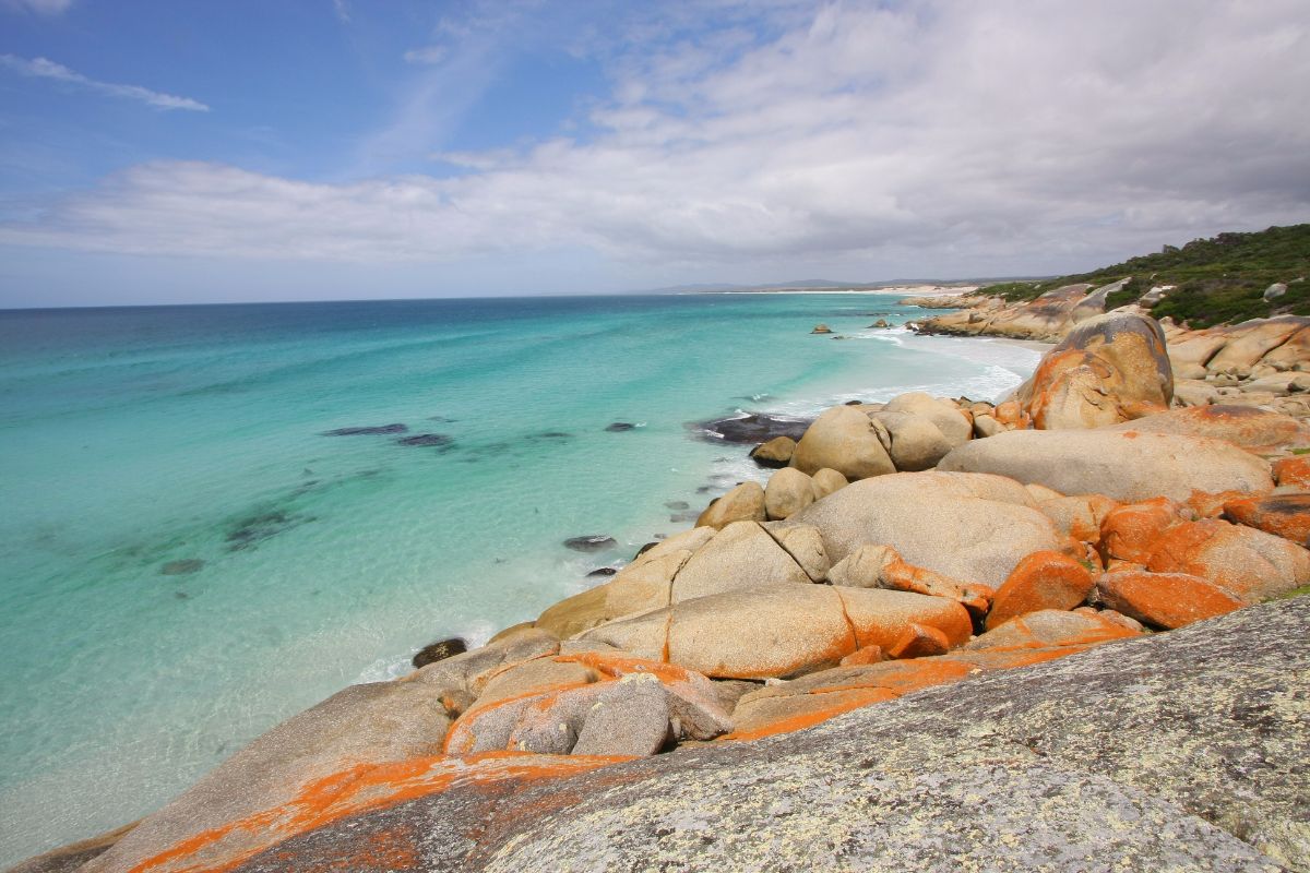
Photo by Anna Oakley CC BY
Extending from Binalong Bay to Eddystone Point, there’s plenty to explore along the Bay of Fires. From a distance, you could be mistaken for thinking that the coast is alight with several fires as Captain Tobias Furneaux once did in 1773, thanks to the startling orange-hued granite lining the shore. Set against white sand and the blue ocean, the bay is genuinely photogenic.
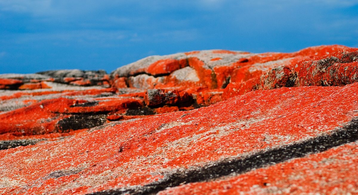
Photo by Mark Huber CC BY
There are plenty of walks you can do freely – simply go for a casual stroll on the beach, or if you’re feeling extra adventurous, take our recommended Cobler Rocks trail in the north of the bay. Don’t forget to bring plenty of water and a good camera – there’s plenty to see including the fire trail, heathland and uninterrupted coastal views stretching all the way out to Eddystone Point.
Distance: 6km
Time: 2 hours
Grade: easy
Starting point: Stumpys Bay no.4 camping area
Find accommodation on the Bay of Fires here.
Cape Hauy, Tasman Peninsula
Best for: woodlands, rock formations and cliffs
Fortescue Bay. Photo by michellesallen
The hike to Cape Hauy is perfect for those who want a mixture of leisurely activity as well as a challenging hike. The route promises to take walkers through a variety of woodlands and heath before emerging to a view of beautiful rock formations and dramatic, steep cliffs. The Candlestick and Totem Pole are formidable rock formations towering from the ocean and are awesome sights to take in.


Photos by tassiegrammer and phillipedelaroche
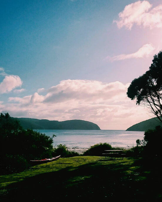
We recommend taking a pair of sturdy shoes as the track can be steep and rough in some areas. Afterwards, take a moment to relax at Fortescue Bay – a romantic sandy white beach surrounded by dense woods. Drinking water, picnic and toilet facilities are available.
Photos by mirajm and jangettmann
Distance: 8km
Time: 4 hours
Grade: medium
Starting point: Fortescue Bay, Tasman National Park
Fortescue Bay is a 45-minute drive from Port Arthur. To find nearby accommodation here, be sure to check on trivago.
Freycinet Circuit, Freycinet National Park
Best for: pristine beaches, granite peaks and panorama views
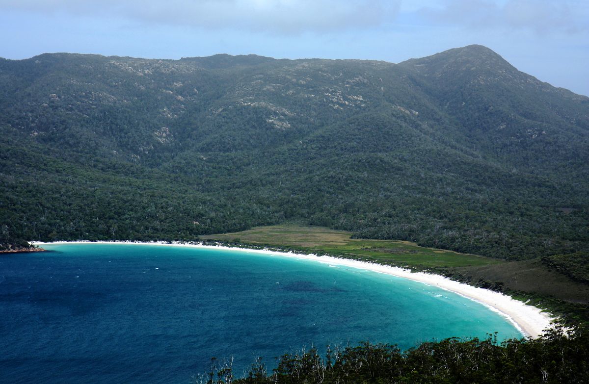
Photo by Andrea Schaffer CC BY

Photo by Stefan Krasowski CC BY
Though a 30km hike may sound long, walkers swear that the Freycinet Circuit is worth it every bit of the way – varied enough to keep hikers in awe, but dry enough so as to avoid ending up with muddy boots. The coastline of the peninsula sees pristine beaches with white sand and turquoise water, while the mountainous landscape provides stunning views of the granite peaks as well as panoramas from the summits of Mount Graham and Mount Freycinet.
Photo by Michael Rawle CC BY-ND
The walking trail is clearly marked but walkers will need to be well-prepared with water, food, a tent and wet weather gear. There is also luxury accommodation available at Coles Bay, where you can treat yourself to a well-deserved hotel stay before or after your journey.
Distance: 30km
Time: 2-3 days
Grade: medium
Starting point: Walking Tracks car park
Driving instructions from Hobart are available here.
Treat yourself to a hotel in Coles Bay here.
Overland Track, Cradle Mountain
Best for: glacially-carved valleys, ancient rainforests and beautiful alpine meadows

Photo by Jenny Mealing CC BY
Not for the faint-hearted, the internationally-acclaimed Overland Track is for explorers who are ready to experience everything that the Tasmanian wilderness has to offer. The World Heritage-listed track starts at Cradle Mountain and finishes at Lake St Claire, Australia’s deepest lake. Over six days of hiking, walkers are promised a journey through glacially-carved valleys, ancients rainforests and eucalyptus bushland as well as beautiful alpine meadows, waterfalls and a climb up Tasmania’s highest peak, Mount Ossa.

Photo by Rick McCharles CC BY

Photo by Rick McCharles CC BY
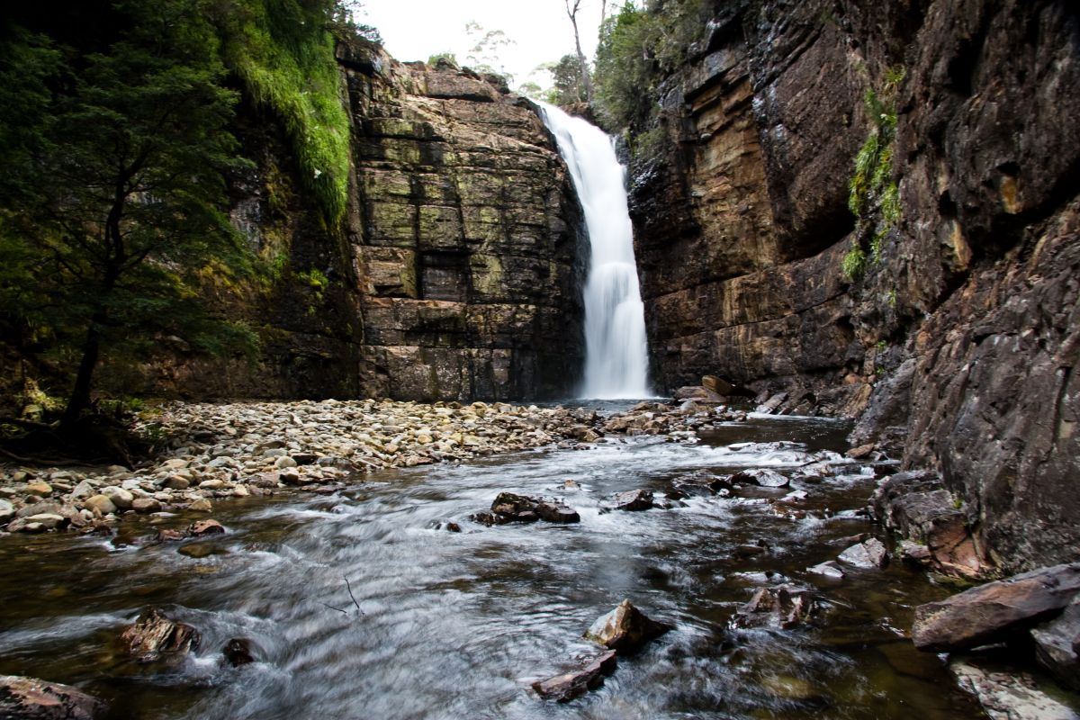
Photo by Julie Edgley CC BY-SA
This is a challenging walk and is recommended for experienced hikers. Although resting facilities, drinkable rain water and basic shelters are provided on the route, hikers should be well-prepared and fully sufficient.
Distance: 65km
Time: 6 days
Grade: difficult
Starting point: Ronny Creek, Cradle Valley
Bookings and fees apply to walks during high season from the 1st October to 31st May inclusive.
Those who prefer a relaxed stay in Cradle Mountain can check a selection of hotels here.
What do you love about Tasmania? Comment below!